TRANSFORMING COMPLEX DATA INTO ACTIONABLE INSIGHTS BY EMPOWERING BUSINESSES WITH ADVANCED IOT MONITORING SOLUTIONS.

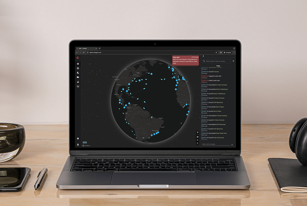
SnapGIS helps customers navigate the complexity of monitoring remote and critical operations by providing an IoT asset management platform that simplifies vast data streams from various assets into coherent, actionable intelligence that enhances operational oversight and efficiency.

SnapGIS solutions

Partner Story

SnapGIS was formed by a team of Dubai-based engineers, bringing together decades of experience in the IoT market. It set out to streamline a fragmented industry where businesses were often burdened with outdated, single-use systems that proved costly and inefficient. 

To that end, SnapGIS has developed a software platform which enables diverse IoT asset management from a single application. By leveraging data from sensors and peripherals, the solution delivers in-depth analytics , helping customers unlock efficiency gains and reduce operational costs.

From trucks to vessels, heavy equipment to pipelines and wellheads, SnapGIS provides businesses with a common operational view, enabling enhanced oversight, safety, and efficiency.

Key benefits

  • Consolidate real-time data into a single platform, enabling swift analysis, alerting and reporting 
  • Provides actionable insights for solving complex problems, improving efficiency and reducing costs through a unified application across various asset types
  • Universal solution, the modular platform, can support projects with a wide range of requirements across almost any industry
  • Comprehensive software development: expertly crafted server- and device-side applications for seamless integration and optimal performance
  • Designed with satellite in mind, enabling seamless connectivity solutions in areas with little or no terrestrial coverage
  • Optimized for low-bandwidth environments, delivering efficient use of customer data
  • Scalable, secure, and simple-to-use software

Features

  • Assimilate various data sources for a common operating platform with real-time information for comprehensive operational oversight
  • Real-time alerts via the application, email, SMS and WhatsApp™, ensuring users can stay informed 24/7
  • Designed with edge computing and satellite connectivity options for enhanced network resilience and efficient bandwidth utilisation
  • In-depth reporting and trend analysis tools enable businesses to improve operations and track progress
  • AI and machine-learning features help customers analyze and monitor data, automating processes to reduce operating costs

User Scenarios

  • Monitor Oil & Gas assets, including wellheads and extensive pipeline networks
  • Improve driver behaviour with automated report cards and performance coaching
  • Analyze fuel consumption to identify wastage, lower costs and reduce carbon emissions
  • Monitor critical infrastructure and reduce unexpected downtime via predictive maintenance and real-time alerts on crucial equipment
"We’re excited to join the ELEVATE program and partner with Viasat to expand the possibilities of IoT, bringing modern, cutting-edge solutions to new and interesting areas.
We aim to redefine what has previously been possible with low-bandwidth satellite connectivity and bring a new world of insights and analytics to our customers"

Kyle Pallo, Managing Director, SnapGIS