Aviation
You may not realise it but satellites orbiting space have become an indispensable and central part of our daily lives. From weather satellites that bring us our daily forecasts to those that beam our favourite TV and radio programmes; the inflight Wi-Fi you have come to expect on your flight, to the connectivity seafarers depend upon for safety at sea. And then, of course, there are Global Navigation Satellite Systems (GNSS) such as the US Global Positioning System (GPS), which we all rely on to get us from A to B, safely and accurately.
Inmarsat has over 40 years’ experience of providing global, mobile satellite connectivity on land, at sea and in the air, and has been at the heart of every major innovation in satellite technology that’s in use today including GNSS.
Over 30 years ago we were at the forefront of pioneering the concept of enhancing satellite navigation systems such as GPS in Medium Earth Orbit (MEO) with separate satellite signals from geostationary orbit (GEO) to boost the accuracy and dependability of GPS data for safety-related users such as aircraft and ships. This concept is called Satellite Based Augmentation System (SBAS).

Working with the European Space Agency (ESA) on its NavSat system studies in 1989, Inmarsat developed specifications for navigation payloads on GEO satellites and built the first prototype Wide Area Augmentations System (WAAS) Signal Generator (SIGGEN) equipment with NAVSYS Corporation. This was deployed at the Goonhilly Earth Station in Cornwall and used to transmit an L-band signal over the Inmarsat Atlantic Ocean Region MARECS satellite to a software-based GPS receiver installed at our Test and Development Laboratory in London.
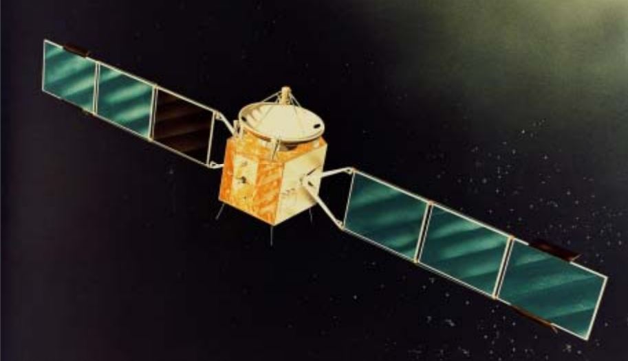 Inmarsat MARECS satellite
Following the successful outcome of this work, the Inmarsat-3 satellite constellation, which launched in the 1990s, featured navigation transponders on all spacecraft for SBAS service provision. Inmarsat then pioneered the SBAS service business with contracts signed with a number of national and international institutional customers. This was followed by a new generation of navigation transponders on the Inmarsat-4 satellite constellation further consolidating the UK’s leadership in global satnav service provision.
More recently, we have deployed our satellite and navigation systems experience to help the UK Government via a key role to develop system design and operations options as part of the UK GNSS programme.
Today, the increased accuracy and integrity that SBAS provides is critical for aviation and is widely used by the geospatial industry. Air navigation SBAS systems in use include WAAS (USA); EGNOS (Europe); MSAS (Japan); GAGAN (India) and SDCM (Russia). Additional SBAS systems under development are SPAN (Australia/New Zealand) and KAAS (South Korea).
Our Inmarsat-4 transponders remain in service for the European Geostationary Navigation Overlay System (EGNOS) and for Geoscience Australia as part of the Southern Positioning Augmentation Network (SPAN). Inmarsat navigation transponders have also been used by the Federal Aviation Authority’s (FAA) Wide Area Augmentation System (WAAS).
But, being Inmarsat, we don’t stop innovating and pioneering the next generation of satellite technology that can relied upon by governments, organisations and industries the world over.
We are working in partnership with ESA once more on Iris, a revolutionary satellite-based communication system to deliver secure, high bandwidth data link communications over Europe.
Using near real-time reporting of 4D trajectory optimisation to allow aircraft to accurately report latitude, longitude, altitude, true heading and ground speed, Iris will modernise air traffic management (ATM) and is a critical element of the Single European Skies ATM Research (SESAR) masterplan to alleviate airspace congestion, reduce flight times and delays, and enhance safety and security.
This is just one example of Inmarsat’s ground-breaking programmes. With our fully funded technology roadmap in place which will see a further seven satellites launched by 2024 to provide increased capabilities and redundancies to our satellite networks, and a ground network expansion unrivalled in our history, we are investing in the power of satellite technology to improve the world we live in for decades to come.

We look forward to helping our customers around the world to harness the power of satellite communication and satellite navigation technology to address the growing societal, security and economic needs in the digital age.