Insight | Case study: NIWA and Inmarsat enable real-time weather monitoring across the Tonga archipelago in the South Pacific
Enterprise
Monitoring weather, climate and environmental change in the South Pacific is essential to understand more about local, regional and global weather systems, and how they are changing. Reliable access to real-time, data-driven climate and weather information in the Pacific Islands enables highly accurate short-term weather forecasts and helps local populations plan to mitigate the worst impacts of climate change through improved cyclone, drought, and flood resilience. It also advances our understanding of how climate change is reshaping weather patterns globally, as the region is a bellwether.
To access the data needed to stay ahead of weather and environmental trends, the National Institute of Water and Atmospheric Research (NIWA) is leveraging the Internet of Things (IoT) and the satellite communications that underpin it. NIWA has recently supported Tonga Meteorological Service (TMS) install a network of reliable, robust, automated weather and sea level monitoring stations able to maintain consistent connectivity, even in the most extreme weather events, including the tsunami triggered by the eruption of the Hunga Tonga–Hunga Haʻapai volcano in the Tongan archipelago in January 2022. Although one weather station was lost to the tsunami’s waves, the rest survived and continued to send data from some of the region’s most remote, exposed, sparsely populated and difficult to reach outer islands of the Tonga archipelago.
The value of satellite was highlighted when the undersea communications cable Tonga relies on for its phone and internet connection with the rest of the world was severed during the eruption. Although weather and sea level data continued to be logged at remote stations, TMS and its dependant agencies were locally blind to that data, because internet access is required to visualise it.
Using a satellite phone connection, the NIWA and satellite solutions providers helped TMS’s technicians create some visibility by cannibalising one of the BGAN M2M terminals from a local monitoring station. This enabled basic internet access to be established, allowing TMS to access data from their network of automatic weather and sea-level stations. In the immediate aftermath of the event, this enabled Tonga’s National Emergency Management Office assess whether large tsunami waves had affected the northern Tongan islands and to support the provision of weather information for initial flyovers of tsunami and ash-impacted islands. Work to define a robust long-term back-up solution to work around the potential loss of the internet cable continues.
NIWA is one of New Zealand’s government-owned Crown Research Institutes (CRIs). Established in 1992, it employs approximately 700 staff and has 27 vessels, including one ice-strengthened one for scientific research in Antarctica. It also runs three supercomputers for modelling work with meteorological organisations worldwide.
NIWA’s work encompasses climate and environmental science projects studying the heights of the upper atmosphere, to the depths of the Pacific Ocean and a great many things in between. Research projects include ozone monitoring, climate change, climate variability, weather forecasting, hazards and risks, coastal and oceanographic modelling, biodiversity and biosecurity, fisheries and stock assessment and more.
Beyond New Zealand, much of NIWA’s applied science work is focused on the Pacific Islands, an area known for cyclones and prone to drought. Over many years, NIWA has supported Pacific Island Hydro-Meteorological agencies install around 260 automatic weather and hydrological monitoring installations scattered throughout the region, enabling vital weather and climate data to be automatically collected and reported, both for forecasting and early warning purposes, as well as providing baseline data to understand more about Pacific weather and climate systems and how they are changing.
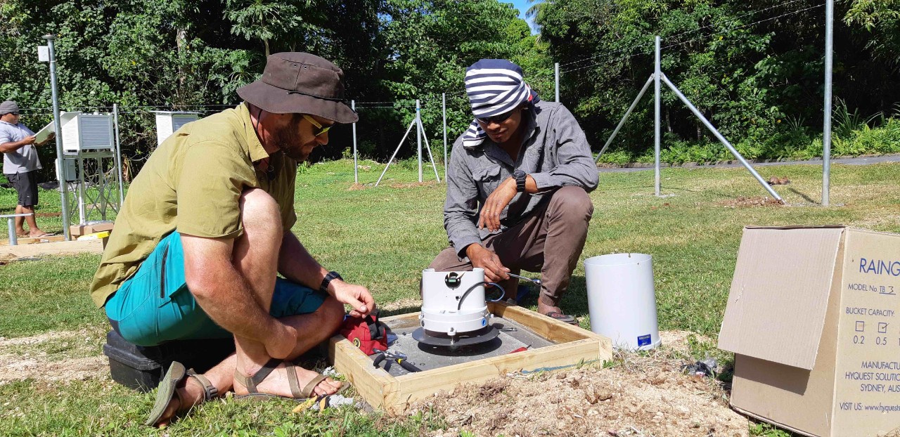 Connecting the sensors. Training is a large part of the Automatic Weather Stations construction and installation process and here, NIWA Technician Eric Stevens demonstrates the operation of a tipping bucket rain gauge to Tonga Meteorological Service staff (Jeremy Rutherford, NIWA)
Despite the Pacific being one of the most climate-impacted parts of the world, baseline data collection had significantly deteriorated in recent decades. Local meteorological services struggled to resource continued manual observations, so the network of monitoring stations set up throughout the twentieth century had fallen away in the 1980s and 1990s.
The resulting lack of timely and accurate weather data impeded access to Tonga’s most remote, northern islands for years. Weather conditions meant pilots could not guarantee a safe landing on the short airstrips on outer islands, as they were often unaware of the conditions before take-off. This not only resulted in the high economic and environmental cost of wasted flights, but it also meant regular aborted trips by local ferry and shipping companies, who were similarly unable to offload passengers or cargo due to rough sea conditions at their destinations.
So, in 2008 NIWA, initially working with the Fiji and Samoa Meteorological Services, set out to try to help to improve the climate, hydrology, and weather monitoring systems across the Pacific Islands region.
One of their latest projects, to install new automated weather stations and sea level monitoring equipment from one end of the Tongan archipelago to the other, has proven to be its most challenging to date.
Working in Tonga presented a huge array of logistical and communication challenges. NIWA’s teams had to plan meticulously to overcome the isolation of monitoring locations and the lack of local travel infrastructure, ultimately chartering a vessel to move twelve members of staff and three container loads of equipment between islands, after an initial plan to use the Tonga Defence Force’s Patrol Vessel fell through.
The other major challenge is that many of Tonga’s more remote islands lacked the local terrestrial or IP cellular communications networks that NIWA’s monitoring systems are set up to use as their primary means of communication. Even if these areas had access to such networks, in this region they are often disrupted during cyclones and other extreme weather events when access to timely weather information is most critical.
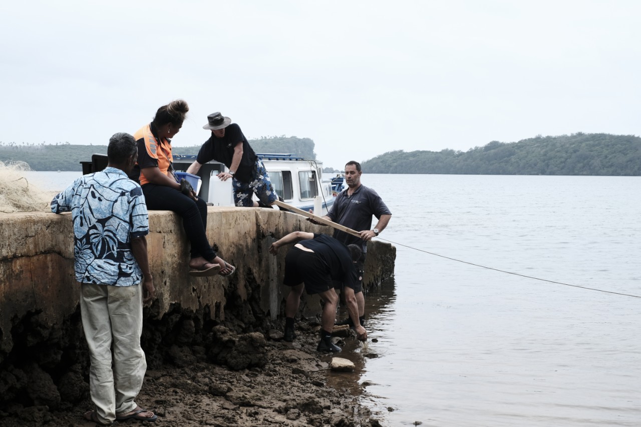 Tide board installation at Hunga Lagoon (Jochen Bind, NIWA)
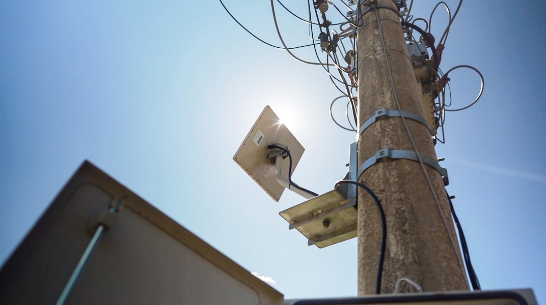
“In countries like Tonga which are isolated and highly cyclone-impacted, BGAN satellite technology is generally an option that survives beyond the cyclone event itself, whereas local cellular and terrestrial connected networks often are damaged during such events,” explains Doug Ramsay, General Manager for Pacific Rim at NIWA. “Across the Pacific region, we need stations that can operate during a 200kmph cyclone, ideally reporting throughout.”
So, to gain a better insight into local weather conditions and climate change trends, using aggregated weather and climate data from across the Tonga archipelago, NIWA and the TMS designed and installed a network of 21 new BGAN-enabled automated weather stations and two sea level monitoring stations. In this extensive weather and coastal monitoring project, each station is telemetered using BGAN satellite technology, reporting back in near real time using NIWA’s NEON telemetry system. It is integrated with CliDe, the climate database developed by the Australian Bureau of Meteorology and with Tideda, NIWA’s own hydrology database, both used by meteorological services across the Pacific region.
“The consistency, reliability, and robust nature of Inmarsat’s BGAN M2M service means TMS can continue monitoring the progress of cyclones, potential droughts, or other extreme weather events, in near real time from their head office in Tongatapu, Tonga’s main island. Maintaining that connectivity to the stations and reporting as these events go through is hugely advantageous to TMS and for met services across the region,” says Ramsay.
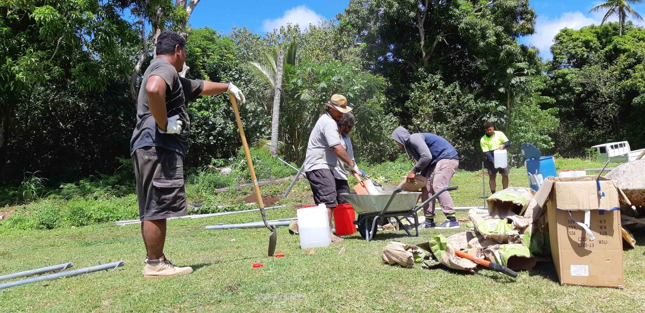 Construction of Automatic Weather Station on Niuatoputapu island, Tonga. Staff from the Tonga Meteorological Service and local construction company, Puloka Construction, mix concrete to pour into hand dug holes to secure the 10 m anemometer mast. With few construction resources on the island, all materials including pre-mixed concrete had to be transported with the installation team. (Jeremy Rutherford, NIWA)
The arrival of robust and affordable satellite communications in Tonga and the wider Pacific region has empowered NIWA to convert the raw data from its BGAN-enabled weather and sea level monitoring stations into near real time, actionable, and impactful weather forecast information both locally and globally by contributing to global weather information systems. Underpinned by Inmarsat’s satellite networks, which provide organisations like NIWA, operating in some of the world’s most remote locations, with seamless, secure narrowband connectivity that is reliable in all conditions, with 99.9% availability, they are always informed of conditions across their network of stations. Effectively, in terms of climate and weather monitoring, it means they have gone from mostly manual to everything automated inside a two-year period.
Using Inmarsat’s BGAN service, accessible via small, lightweight, ultra-portable and rugged terminals such as the Hughes 9502 BGAN M2M, also helps TMS keep the costs of transmitting essential weather and climate data to an absolute minimum, by recording these data points at ten-minute intervals and then aggregating them to transmit on an hourly basis in small packets totalling around 30 kilobytes a day.
“The arrival of the BGAN M2M service has allowed us to think about doing things that we only dreamt of previously,” says Graham Elley, Chief Scientist for Environmental Monitoring at NIWA. “BGAN has been a huge enabler, both for the day-to-day livelihoods of people in Tonga, but also to feed regional data into global information systems such as those operated by the World Meteorological Organisation (WMO). Enabling the WMO to take data points from across Tonga’s islands helps them develop detailed weather information and climate change projections that are essential for local industries, assets and infrastructure management. Regular access empowers WMO and other regional organisations to provide hugely-beneficial climate forecasting models that help understand more about the Pacific, and indeed global, weather systems and equally important, how they may change in the future.”
“Plus, the reliability of the Inmarsat systems has decoupled us from having to deal with the random outages associated with land-based communications infrastructure. BGAN is robust, affordable and has enabled us to develop and rapidly grow the network and availability of monitoring stations to places that had little or nothing other than manual systems in place.
TMS can now easily and reliably record all the weather, climate and environmental data from its monitoring network in Tonga. The network design is intentionally consistent with all stations that NIWA has assisted Pacific Meteorological Services with across the region, aiding knowledge sharing and the experience of operating and maintaining the network between the various meteorological services.
“The key thing is that Tonga Meteorological Service can now use this growing archive of data and turn it into highly valuable information that local people, businesses, health and travel services and others can make informed decisions upon,” says NIWA’s Doug Ramsay.
“After all, it’s not just about collecting data, it’s about collecting data that can be built into decision-relevant information that make a difference, both to the local inhabitants and globally. Consider drought monitoring and reporting, for example, something that was traditionally conducted by manually recording rainfall and then sharing that information monthly. With our BGAN-enabled weather monitoring stations, this information is now updated hourly, which means government can now plan ahead and proactively respond with actions like shipping essential drinking water to outer-islands hit by droughts in a timely manner and Tonga’s agricultural businesses can better plan and manage the impacts on crop growth of weather and climate conditions.”
“When we look forward to things such as the impact of climate change, these are going to be some of the most-affected nations in the world,” says Ramsay. “They will now be significantly better forewarned of the changes occurring and what the potential impacts on each of those island groups are, because of our ability to automatically measure and reliably consolidate data into systems that can turn it into useful information.”
During the tsunami, access to such data enabled several international agencies to quickly assess whether large, damaging tsunami waves had reached Tonga’s northern islands when all other communications were down. As the domestic mobile phone network was also knocked out for several days and once restored, limited capacity was a prolonged problem, knowing which islands had been severely impacted enabled the response agencies to focus their efforts accordingly. The weather stations also recorded the atmospheric pressure waves from the eruption very well, with the continual feed of data useful in confirming the occurrence of ongoing smaller eruptions in the days following the main event. In operating throughout, the system demonstrated very well the robustness of a dual communications set-up. As a result, Tonga is now considering this as a back-up to the single undersea cable, to increase the resilience of their international communications connections.
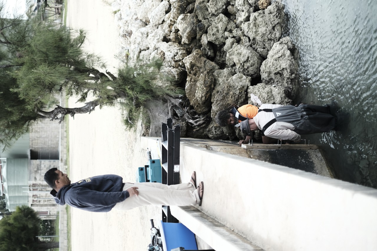 Tide board installation near Pangai Ferry Terminal (Jochen Bind, NIWA)