Insight | Satellite communications in reducing emissions in aviation and maritime
Corporate
Landmarks. Birds. Stars. Ocean swells. Wind. Sun. Magnetism. Time. Radio waves.
As I am sure the members of the Royal Aeronautical Society will know, this is not a random list. Instead, it is a compilation of some of the many things that have made navigation possible since the beginning of human existence.
Today, they might seem impossibly ‘low-tech’, but let’s not forget that some of the Earth’s first great oceanic explorers, the Polynesians, were able to reach Hawaii, New Zealand, Easter Island, maybe even South America, starting as early as 2000 BC. And, to my amazement, they did so without the benefit of an Inmarsat radome on the masts of their ships.
Navigation started on land and then moved to sea and finally into the air. Each generation better, smarter and more precise. Many of the civilisations that have led in the route-finding systems of their time found themselves as dominant powers. Phoenicians, Greeks, Romans, Arabs, early societies of the Indus basin, Vikings and, of course, much later, the British.
There is a lesson in this history: navigation can solve great problems. It can ease trade. Spread learning. Create wealth. Foster new technologies. And, now we need it to come to our aid once again. Because we need help.
Global warming is an existential threat to the entire natural world. And, it is a threat that we have created. I know not everyone believes this to be true. ‘Wait a moment,’ they exclaim, ‘temperature on the planet has varied massively over time. What we are seeing is just a normal cycle.’
Nonsense. I don’t buy this, and neither should you.
Natural cycles simply do not explain the increases in atmospheric carbon dioxide we have seen since the start of the Industrial Revolution. The concentration of CO2 has been rising exponentially since that time, at a rate of about 0.17 per cent per year. Most of that is the result of the combustion of fossil fuels.
So, I join with the vast majority of scientists in accepting that climate change has resulted from human activity over the past century. And, it is not getting better. To quote a well-known phrase in the aerospace world, ‘Houston, we have a problem.’ Of course, pointing to the problem is the easy part. Unfortunately, it is the solution that is hard.
I was pleased to see that the recent United Nations COP26 conference in Glasgow reaffirmed the goal of limiting the rise in global warming to 1.5 degrees Celsius. That requires every country, every company, every individual, to do their part.
We are stepping up at Inmarsat. We have set company goals to reduce our emissions by almost two-thirds by 2030. That will be more than enough to do our part to achieve the 1.5 degree limit. The reality, however, is that we are small, and as a result, our direct impact is small. Where we make a big, big difference is in the broader ecosystem, working with our customers and partners.
That is what I want to talk about today: how satellite communications can reduce emissions in aviation and maritime. That is something that Inmarsat is superbly positioned to do, given that we provide a primary communications network for the world’s maritime industry and 90 per cent of transoceanic airliners.
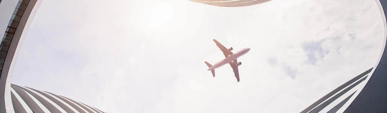
Let me share three examples, starting with aviation. Aviation emits a lot of CO2, roughly 2.5 per cent of the world’s annual total. Its total impact on global warming is generally considered to be about 1 percentage point higher, at about 3.5 per cent. In short, it is significant.
One way to reduce that impact is better navigation. If you can route your aircraft on the most efficient path from A to B and then, even better, plot a path where more and more aircraft can fit on that path while avoiding congestion on take-off and before landing … well, you are on to something.
Inmarsat has been supporting these kinds of improvements for years. With our technology that is in most commercial aircraft cockpits today, planes can fly safely closer on optimal routes and find more efficient paths through increasingly congested airspace. We are proud of that, but it is not enough. Somewhere between 5 and 10 percent of the C02 emitted by flights today is still estimated to be avoidable. It is the result of outdated aviation infrastructure that causes long trajectories and congestion in the air. It is clearly time for an update to the system. And, to all the policymakers in the audience, I would say let’s get on with it at full speed.
We are proud to be working with the European Space Agency on a system called Iris, which is being undertaken as part of the European Commission’s Single European Sky ATM Research programme.
Based on Inmarsat’s safety-ready ELERA network, Iris can pinpoint an aircraft in four dimensions – latitude, longitude, altitude and time – using ‘4D trajectories’. It enables flights to be precisely tracked and traffic efficiently managed through Trajectory-Based Operations. Pilots and air traffic controllers can calculate the shortest available routes, cruise at optimum altitudes and use continuous climb and descent paths, saving fuel and lessening aviation’s environmental impact.
With Iris deployed on the Inmarsat ELERA network, aircraft will be able to fly even more closely than today with zero reduction in safety. This means the industry will be able to double or even triple the number of planes in the proximate airspace while flying environmentally optimised trajectories.
Pretty amazing. In my previous role as CEO of Nokia, I used to sell a lot of 5G. It can do many great things, but it can’t do this. Only satellites can.
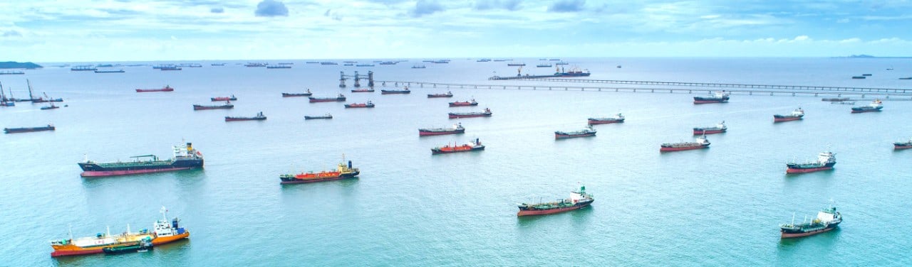
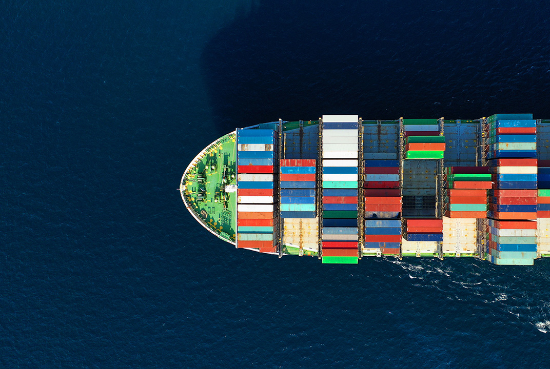
Next, maritime. Estimates put the CO2 emissions from the maritime industry at very roughly the same level as aviation. Its share of global emissions has actually increased since 2012, despite the introduction of significantly more efficient vessels. If left unchecked, there are estimates that maritime emissions could continue to rise by as much as 250 per cent.
Pleasingly, the International Maritime Organization has stepped up to the challenge and set a target to cut CO2 emissions by 50 per cent by 2050. That won’t happen because we wish it. It will happen only if we use new technology to do things in new ways. That will be a challenge for maritime.
While the sector has some fantastic innovators, many of whom we are proud to call customers, it is not known for its speed of change. There is a real opportunity to accelerate that pace and adopt digital technologies for vessels of all kinds to maximise efficiency of routing and vessel performance.
Without satellite-enabled communications, an industry-wide digitalisation strategy would be impossible. Fortunately, with new generations of satellite technology over the past decade, we have seen the industry go from sceptical to becoming strong embracers of the operational and environmental benefits of digitalisation. This is not just pie in the sky. We are seeing it today.
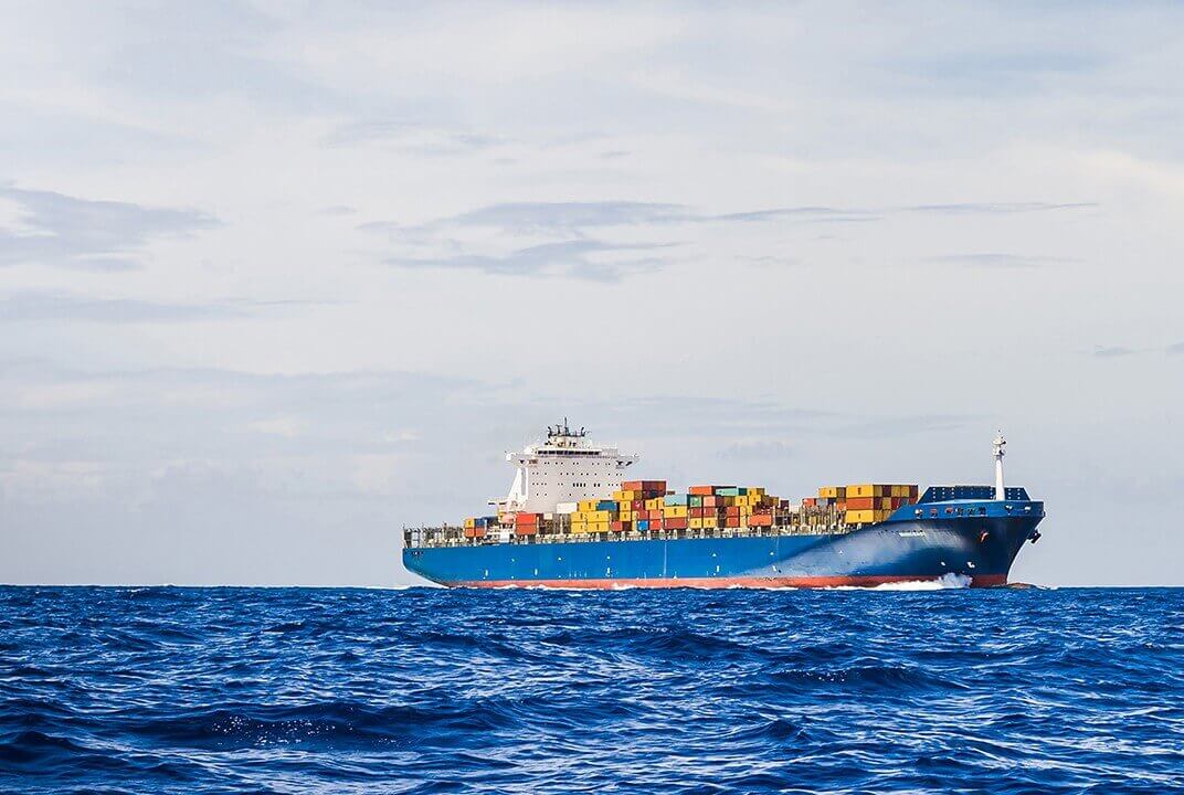
Consider the case of Eastern Pacific Shipping, a leading operator of container ships, dry bulk and tanker vessels. EPS installed software from Nautilus Lab, an Inmarsat Certified Application Provider, on six vessels in 2019, and have since extended that to the rest of their fleet.
To illustrate the potential, Nautilus data was used on a tanker voyage from Scotland to Nigeria and onwards to Indonesia. Despite the ship needing to stop in South Africa for a medical emergency, the data feeds of the Nautilus platform showed a 30.5 metric tonne fuel saving and a 4 per cent uplift in what is called ‘time charter equivalent’ earnings – a measure of profitability – throughout the voyage.
Remarkably, the technology helped that vessel avoid 95 metric tonnes of CO2 emissions. Depending on where you live, that’s roughly like taking 21 cars off the street for an entire year. So, if you do that for the 60,000-plus vessels in the world maritime fleet today, you could probably park the equivalent of entire cities’ worth of cars.
The incentive for change is undoubtedly there for vessel owners. Finland’s Aalto University estimated that on-board digital technologies could improve voyage profitability up to 17.8 per cent among mid-range tankers due to voyage optimisation alone. As someone who runs a business, if I was offered a path to an almost 18 per cent profitability uplift while also doing good for the planet … well, count me in.
Last example: the Internet of Things. You probably all know the stats on the number of connected devices now and in the future. Big numbers and getting bigger all the time. But here’s the thing: many of those connected devices can only be connected by satellites. Terrestrial solutions are good but do not have the global coverage and reliability needed for many applications.
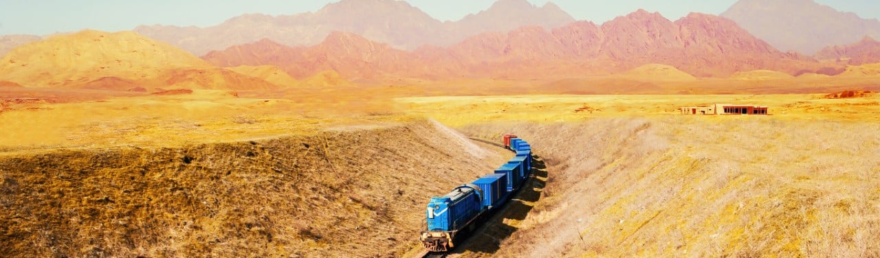
Our ELERA network is, quite literally, everywhere, and has the right combination of exceptionally high reliability and throughput for IoT. Let me give just one example: Rumo, the largest railway operator in Brazil. The company operates 12 trans-shipment terminals, 6 port terminals and approximately 14,000 kilometres of railways. Some of the country it covers is pretty inaccessible. In my old job, I learned that even if you install terrestrial mobile equipment in certain parts of the world that works one day, it might not work the next. At Nokia, we had equipment destroyed by floods, torn apart by monkeys, short-circuited by nests of cobras.
I have seen remote power supplies for mobile systems that have been destroyed by an angry rhinoceros. Not a pretty sight, and it can take some time to get back online. In space, we have the growing issue of debris – and I will come back to this topic – but last I checked, no angry monkeys or frustrated rhinos. But as a result, excellent reliability … and that matters in large countries like Brazil.
The railway system in Brazil is essential for the transport of agricultural, industrial and container cargo. Rumo connects the largest production centres to the main ports in Brazil and in 2019, its network transported 58 million tonnes of freight. By deploying satellite communications to link multiple IoT devices both at fixed points across their rail network and on the trains themselves, we have helped Rumo produce immediate results.
In addition to operational efficiencies, one significant benefit has been eliminating unnecessary braking and acceleration, creating substantial fuel savings for diesel-powered trains. It all contributes to projected energy savings running into millions of dollars each year.

I have given you examples of smart navigation helping in the battle against climate change in three fields that Inmarsat serves. We have hundreds of such examples. To meet our climate goals, however, we need thousands of such examples. Only with that scale will we make a real difference globally.
But, and there is a large ‘but', for space to support sustainability on Earth, there needs to be sustainability in space. And, to be blunt, we are moving in the wrong direction here. The problem is in three primary areas.
First, low-earth orbit mega-constellations risk creating a massive amount of space debris. Consider that in 2014 there were 1,200 active satellites in orbit. Six years later, that number was approaching 5,000. Today, mega-constellations are talking about tens of thousands of new satellites during this decade – satellites with an expected life of only five to ten years. The resulting debris creates hazards not just in a particular orbit, but for anything passing through that orbit.
We simply do not yet understand all the risks this creates and we do not yet have all the technologies needed to manage the situation effectively.
If these mega-constellations gave us immediate access to something we do not have today, or that we can get in less risky ways, they might be worth considering. But, they do not, and I do not think it makes me a Luddite to say let’s understand more now rather than regret things later.
The second challenge is an environmental one that is also not well understood.
The journal Nature noted that satellite re‑entries from one of the mega‑constellations alone could deposit more aluminium into Earth’s upper atmosphere than is deposited through meteoroids, becoming the dominant source of high‑altitude alumina. This would risk reflecting solar radiation in an uncontrolled manner, which senior scientists have said could create severe consequences for the environment on Earth. I don’t think we know enough now to say if this is a serious issue or not, but again, let’s understand better and only then act.
Finally, there is the issue that is politely known as ‘orbital congestion,’ but which I … a bit more directly … call ‘orbital exclusion.’ What are the risks that one single company or country can put so many satellites in a single orbit that no other can possibly fit in? Is that good for competition and innovation? Is it good for the consumer? Maybe, maybe not … but some more global thinking on this issue would be wise before it is too late.
To be clear, we think there is a role for LEO constellations, and have plans for our own small and highly targeted LEO satellite constellation as part of our ORCHESTRA network of the future. And, we have no objection to fast action as long as that action is also sensible for the long-term.
So, to summarise …
Navigation has made a difference to human existence since our earliest days.
Global warming is a real existential threat.
Better navigation in aviation, maritime and things on the move can help address that threat.
Good work is already under way, but we need more, faster.
Sustainability on Earth needs sustainability in space.
Rajeev was appointed as Inmarsat’s Chief Executive Officer in March 2021. He joined Inmarsat from Nokia, where he was most recently President and Chief Executive Officer. From 2009 to 2014 Rajeev was Chief Executive Officer of Nokia Solutions and Networks. During his tenure as CEO, he transformed Nokia into a top two telecommunications infrastructure company, led the consolidation of the sector from ten to three major players, positioned Nokia as a leader in a world connected by 5G and shaped by increasing digitalisation and automation.
Rajeev has lived and worked in the Middle East, Asia, Africa and Europe. In March 2021, he was reappointed as a Commissioner of the United Nations Broadband Commission and in March 2022 he was elected new Chair of the Global Satellite Operators Association (GSOA).